Fire Beacon Hill Local Nature Reserve
Content

As its name suggests, Fire Beacon Hill was the site of one of the beacons used to inform Elizabethan London of the approaching Spanish Armada. At that time the entire East Hill escarpment would have been covered in lowland heath vegetation, similar to that found here. Unfortunately, just this small patch remains, as lowland heath has disappeared due to forestry plantation and agricultural improvement, making this habitat increasingly uncommon.
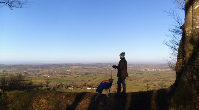
On a clear day you can almost see from Berry Head to Portland, the entire length of Lyme Bay, and on a windy day you are on an eye level with soaring Buzzards and Ravens.
Yellowhammers breed on the Local Nature Reserve, as does the nationally scarce Dartford Warbler. Look out for them skulking amongst the low growing bushes. A good tip to spotting ‘Dartfords’ is to look out for the more conspicuous Stonechat. These beautiful birds sit prominently on trees and shrubs making a distinctive call, like two stones being hit together. When you see a Stonechat, look in the bushes beneath and you may see a Dartford Warbler, using the Stonechat above as a sentry keeping watch.
Nightjars are heathland specialists that can be heard at night hunting for Moths over the nature reserve. During the day they remain perfectly camouflaged, nesting on the ground.
Grayling Butterflies breed on the nature reserve. About the same size as a Tortoiseshell, Graylings are often disturbed into flight while sunbathing on the paths.
A small number of Exmoor ponies and Belted Galloway cattle are grazed in a fenced area of the site as part of the management plan.
The site is a good example of partnership working in action. It is owned by Sidmouth Town Council, and Wild East Devon work in partnership with RSPB Aylesbeare team to manage and run events on the site.
Latest news:
Virtual Fencing
We are trialling a new virtual fencing software on Fire Beacon Hill. The software comes from the Norwegian company ‘Nofence’, following initial development and successful tests on goats through 2011-2016, the software and collar system has been approved for use for cattle within the last few years, and trial projects in the UK became a possibility at the start of 2020.
How it works
A robust collar equipped with GPS tracking software is worn by all individual cattle in a herd. Collars are powered by solar panels plus a battery which can last up to 3 months without needing to be recharged. Collars are linked via the Nofence server to an app system where we can draw bespoke boundaries around a grazing area on a satellite map. The boundaries can be updated as regularly as needed and can also exclude features within the grazing area.
When the GPS in the collar notices an animal is getting closer to the virtual boundary it warns the animal with an audio cue. If the animal turns around and walks back within the boundary the audio signal will turn off and there will be no further action. If the animal ignores the audio warning and continues to walk through the boundary it will receive an electric pulse from the collar in the same way it would receive one from touching an electric fence, and we will be notified of the delivery of the electric shock. In the unlikely event the animal continues to walk out of the boundary after receiving an electric pulse, after a set distance and we will immediately receive an alert via the app or a text that the animal has escaped and the collar will continue to track the animal’s position. To avoid this as much as possible, our cattle will be introduced to the collars within an initial fenced area, where the predictable audio tone and mild electric shock will allow the animals to learn what the audio signal means and how to prevent the electric shock.
Visit the local Flip Flops or Wellies blog for a visitor's view of experiencing Fire Beacon Hill.
Location
From the A3052, heading towards Sidmouth from Newton Poppleford, turn left off the main road at the Bowd Inn, signposted Ottery St Mary. Take the first turning right and then next left, 100 metres further on there is a public footpath to the right, leading directly up to the top of the hill. The site does not have a postal address. The nearest postcode is EX10 0ND. What3Words: Core Hill Road Car Park ///withdraw.gushes.motivates Top of hill ///nights.defend.introduce
Directions
Get directions to Fire Beacon Hill Local Nature Reserve nature reserve with Google Maps.
Parking
View parking and walking routes on the Fire Beacon Hill map.
Opening times
All Wild East Devon Nature Reserves are open to the public at all times and are free to visit.
Facilities
Parking
Access
The steep gradients and uneven nature of the footpaths and bridleways make it unsuitable for wheelchair access.
Walking information
The site is criss-crossed with bridleways, footpaths, fire-breaks and the East Devon Way, so exploring on foot is easy. Paths may be muddy in wet weather.
Dogs
Please keep dogs under close control, and clean up after them.
